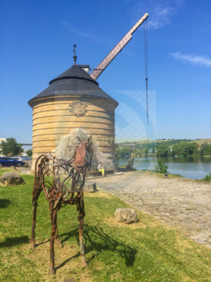
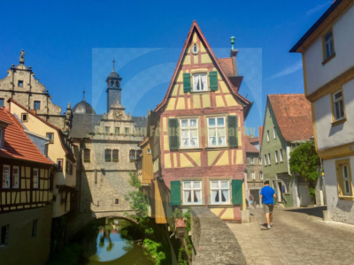
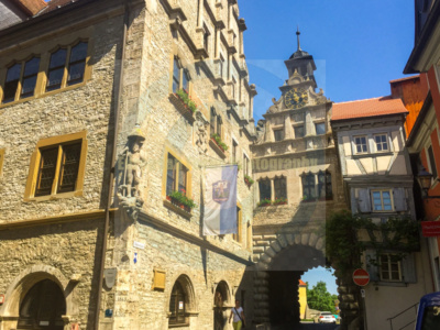
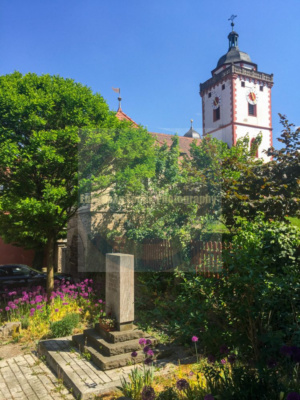
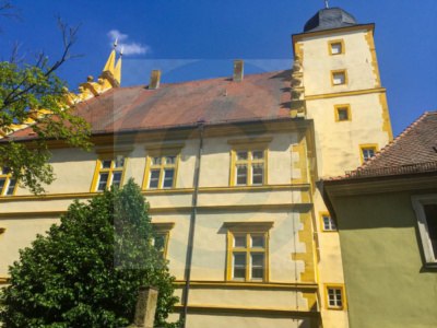
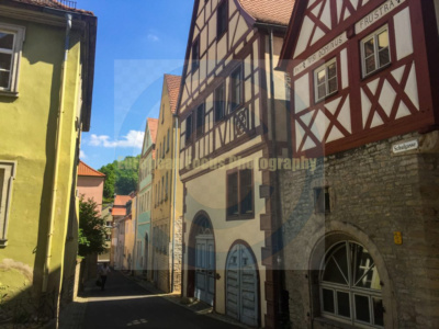
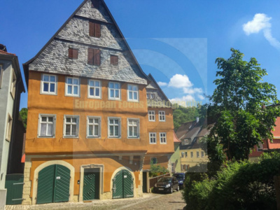
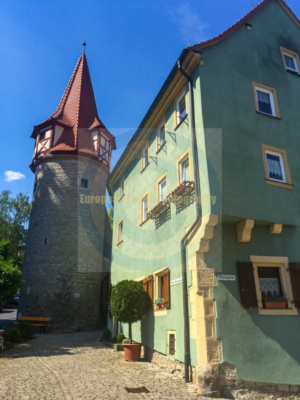
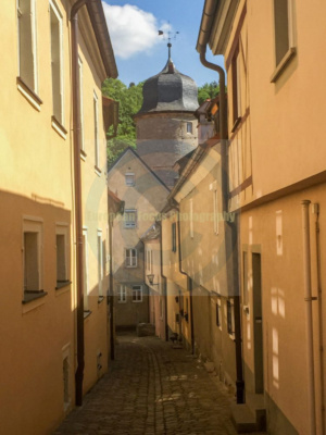
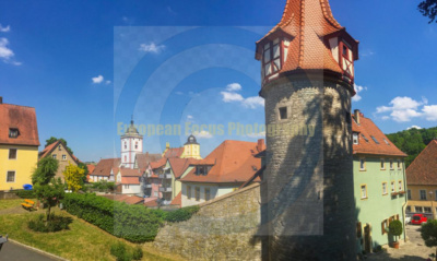
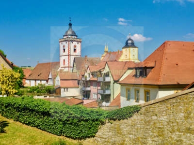
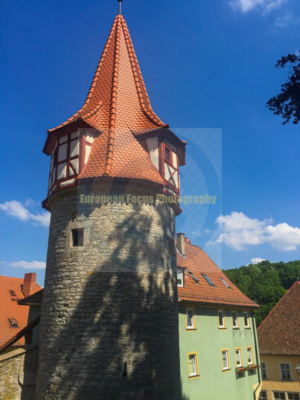
Skip to content
  • Home
  • About
  • European Ancestry PhotosExpand
    • Ancestral Towns of Austria
    • Ancestral Towns of Belgium
    • Ancestral Towns of Croatia
    • Ancestral Towns of Czech Republic
    • Ancestral Towns of Denmark
    • Ancestral Towns of England, Wales, Scotland
    • Ancestral Towns of France
    • Ancestral Towns of Germany
    • Ancestral Towns of Italy
    • Ancestral Towns of Ireland
    • Ancestral Towns of Luxembourg
    • Ancestral Towns of Netherlands
    • Ancestral Towns of Norway
    • Ancestral Towns of Poland
    • Ancestral Towns of Spain
    • Ancestral Towns of Sweden
  • General Interest ImagesExpand
    • Beautiful Images from Europe
  • ContactExpand
    • Account
    • Cart
    • License Agreement – Terms and Conditions

Photos of European Towns and Villages

Photos of European Towns and Villages
  • European Ancestry Photo Galleries
  • Store
  • Favorites
  • Gift Cards
  • Cart0
  • Checkout
  • Login
  • Sign Up

Marktbreit, Bavaria

  • Return to Ancestral Towns of Germany
  • Visit store

Marktbreit was photographed by James Derheim, European Focus Private Tours, in April and September, 2018

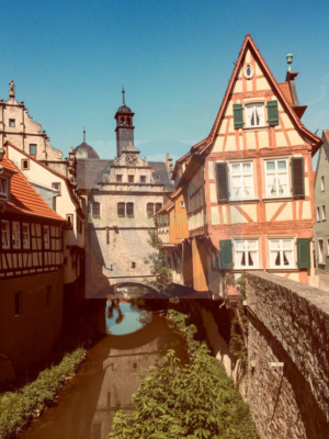
Marktbreit am Main (German pronunciation: [maʁktˈbʁaɪt] ⓘ) is a town in the district of Kitzingen in the Regierungsbezirk Unterfranken in Bavaria, Germany. It is situated at the most southern point of the Main river. Marktbreit is the birthplace of Alois Alzheimer who first identified the symptoms of what is now known as Alzheimer’s disease. With its suburb Gnodstadt [de], Marktbreit has around 3,700 inhabitants.

Roman settlement

Main article: Roman camp, Marktbreit

Near Markbreit, the site of a large Roman legionary fortress (or castrum legionarium) known locally as the Römerlager Marktbreit, was discovered in 1985 and celebrated as a minor scientific sensation because it was never suspected that a legionary fortress was built so far northeast in enemy territory.[3] It was built in Augustan times in enemy territory beyond the “Limes” frontier in preparation for an invasion of the rest of Germany.[4]

It was identified on aerial photos in 1985, and archaeologists were active in 1986-1992. The palisade (2¼ km long, using 21,000 trees) appeared to be finished and several buildings were complete. The surface area of 37 ha suggested that the base was built for two legions or one legion and many auxiliary troops. There were no traces of actual occupation and it took some time to conclude that this was not the result of erosion, but from the fact that the base had been prepared but was never used.

The headquarters (praetorium), the residences of three centurions, store rooms (horrea), and kilns had already been finished before the settlement was abandoned. There are no traces of violence, and precious objects appear to have been taken away, which suggests that the Marktbreit castrum was evacuated when strategic realities had changed and made it unnecessary.

However, a rebellion in Pannonia delayed the execution of the invasion plan, and the defeat of Varus in the Teutoburg Forest put an end to all Roman ambitions east of the Rhine, and the base was never used.

Later history

Alter Kranen

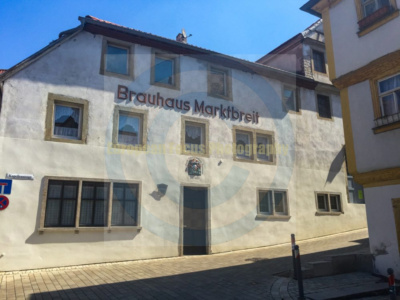
Gnodstadt was first mentioned in a document in 1124. Marktbreit was first mentioned as “broite inferior” in a document of the Count of Castell in 1258. From 1351 Gnodstadt was ruled by Hohenlohe-Brauneck. In 1557, King Ferdinand granted Marktbreit the right to hold markets, thus the name “Markt”breit that has since been used.[5]

In the 17th and 18th century Marktbreit was an important marketplace because the shortest way to the Danube from the Main (which flows into the Rhine) starts in Marktbreit.

In 1806, Marktbreit came to the Kingdom of Bavaria.[5]

Gnodstadt became a part of Marktbreit on 1 May 1978.


Marktbreit
Marktbreit
Marktbreit
Marktbreit
Marktbreit
Marktbreit
Marktbreit
Marktbreit
Marktbreit
Marktbreit
Marktbreit
Marktbreit
Marktbreit
Marktbreit
Marktbreit
Marktbreit
Marktbreit
Marktbreit
Marktbreit
Marktbreit
Marktbreit
Marktbreit
Marktbreit
Marktbreit
Marktbreit
Marktbreit
Marktbreit
Marktbreit
Marktbreit
Marktbreit
Marktbreit
Marktbreit
Marktbreit
Marktbreit
Marktbreit
Marktbreit
Marktbreit
Marktbreit
Marktbreit
Marktbreit
Marktbreit
Marktbreit
Marktbreit
Marktbreit
Marktbreit
Marktbreit
Marktbreit
Marktbreit
Marktbreit
Marktbreit
Marktbreit
Marktbreit
Marktbreit
Marktbreit
Marktbreit
Marktbreit
Marktbreit
Marktbreit
Marktbreit
Marktbreit

European Focus, Inc.

Address

1748 Independence Blvd
Suite F-6
Sarasota, FL 34234

Phone: 941-666-0668

Facebook X Instagram

© 2026 Photos of European Towns and Villages

Under Construction.

We are in the process of building our exclusive Ancestral Town Photo Archive.

Images will be available for purchase soon.

  • Home
  • About
  • European Ancestry Photos
    • Ancestral Towns of Austria
    • Ancestral Towns of Belgium
    • Ancestral Towns of Croatia
    • Ancestral Towns of Czech Republic
    • Ancestral Towns of Denmark
    • Ancestral Towns of England, Wales, Scotland
    • Ancestral Towns of France
    • Ancestral Towns of Germany
    • Ancestral Towns of Italy
    • Ancestral Towns of Ireland
    • Ancestral Towns of Luxembourg
    • Ancestral Towns of Netherlands
    • Ancestral Towns of Norway
    • Ancestral Towns of Poland
    • Ancestral Towns of Spain
    • Ancestral Towns of Sweden
  • General Interest Images
    • Beautiful Images from Europe
  • Contact
    • Account
    • Cart
    • License Agreement – Terms and Conditions
Search