Great Yarmouth, Norfolk
Photographed by James Derheim, European Focus Private Tours, in May of 2018
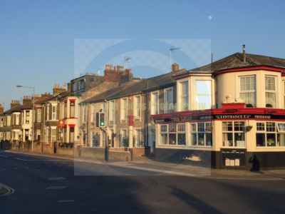
Great Yarmouth (/ˈjɑːrməθ/ YAR-məth), often called Yarmouth, is a seaside town which gives its name to the wider Borough of Great Yarmouth in Norfolk, England; it straddles the River Yare and is located 20 miles (32 km) east of Norwich.[3] Its fishing industry, mainly for herring, shrank after the mid-20th century and has all but ended.[4] North Sea oil from the 1960s supplied an oil rig industry that services offshore natural gas rigs; more recently, offshore wind power and other renewable energy industries have ensued.
Yarmouth has been a resort since 1760 and a gateway from the Norfolk Broads to the North Sea. Holidaymaking rose when a railway opened in 1844, bringing easier, cheaper access and some new settlements. Wellington Pier opened in 1854, and Britannia Pier in 1858. Through the 20th century, Yarmouth boomed as a resort, with a promenade, pubs, trams, fish-and-chip shops, theatres, the Pleasure Beach, the Sea Life Centre, the Hippodrome Circus, the Time and Tide Museum and a Victorian seaside Winter Garden in cast iron and glass.
Great Yarmouth (Gernemwa, Yernemuth) lies near the site of the Roman fort camp of Gariannonum at the mouth of the River Yare. Its situation having attracted fishermen from the Cinque Ports, a permanent settlement was made, and the town numbered 70 burgesses before the Norman Conquest. Henry I placed it under the rule of a reeve.
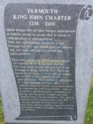
In 1101, the Church of St Nicholas was founded by Herbert de Losinga, the first Bishop of Norwich, and consecrated in 1119. This was to be the first of several priories founded in what was a wealthy trading centre of considerable importance. In 1208, King John granted a charter to Great Yarmouth. The charter gave his burgesses of Yarmouth general liberties according to the customs of Oxford, a gild merchant and weekly hustings, amplified by several later charters asserting the rights of the borough against Little Yarmouth and Gorleston. The town is bound to send to the sheriffs of Norwich every year “one hundred herrings, baked in twenty-four pasties”, which the sheriffs are to deliver to the lord of the manor of East Carlton, who is then to convey them to the King.[9]
A hospital was founded in Great Yarmouth during the reign of Edward I by Thomas Fastolfe, father of Thomas Fastolf, Bishop of St David’s. In 1551, a grammar school was founded, and the great hall of the old hospital was appropriated for its use. The school was closed from 1757 to 1860 but re-established by charity trustees and settled in new buildings in 1872.

In 1552, Edward VI granted a charter of admiralty jurisdiction, later confirmed and extended by James I. Elizabeth I came to Great Yarmouth in July 1578.[10] In 1668 a charter from Charles II extended the borough boundaries to also include Little Yarmouth (also known as Southtown), which lay on the opposite bank of the Yare in the parish of Gorleston in Suffolk.[11] In 1703 a new charter from Queen Anne replaced the two bailiffs by a mayor. In 1673, during the Third Anglo-Dutch War, the Zealand Expedition was assembled in the town. In 1702, the Fishermen’s Hospital was founded.[12] In the early 18th century, Yarmouth, as a thriving herring port, was vividly and admiringly described several times in Daniel Defoe’s travel journals, in part as follows:[13]
Yarmouth is an ancient town, much older than Norwich; and at present, tho’ not standing on so much ground, yet better built; much more compleat; for number of inhabitants, not much inferior; and for wealth, trade, and advantage of its situation, infinitely superior to Norwich.
It is plac’d on a peninsula between the River Yare and the sea; the two last lying parallel to one another, and the town in the middle: The river lies on the west-side of the town, and being grown very large and deep, by a conflux of all the rivers on this side the county, forms the haven; and the town facing to the west also, and open to the river, makes the finest key in England, if not in Europe, not inferior even to that of Marseille itself.
The ships ride here so close, and as it were, keeping up one another, with their head-fasts on shore, that for half a mile [800 m] together, they go cross the stream with their bolsprits over the land, their bowes, or heads, touching the very wharf; so that one may walk from ship to ship as on a floating bridge, all along by the shore-side: The key reaching from the drawbridge almost to the south-gate, is so spacious and wide, that in some places ’tis near one hundred yards from the houses to the wharf. In this pleasant and agreeable range of houses are some very magnificent buildings, and among the rest, the custom-house and town-hall, and some merchants’ houses, which look like little palaces, rather than the dwelling-houses of private men.
The greatest defect of this beautiful town, seems to be, that tho’ it is very rich and encreasing in wealth and trade, and consequently in people, there is not room to enlarge the town by building; which would be certainly done much more than it is, but that the river on the land-side prescribes them, except at the north end without the gate…

In 1797, during the French Revolutionary Wars, the town was the main supply base for the North Sea Fleet. The fleet collected at the Yarmouth Roads, from whence it sailed to the decisive Battle of Camperdown against the Dutch fleet.[14]
Again in 1807, during the Napoleonic Wars, the collected fleet sailed from the roadstead to the Battle of Copenhagen.[15]
From 1808 to 1814, the Admiralty in London could communicate with its ships in Yarmouth by a shutter telegraph chain. Ships were routinely anchored offshore during the Napoleonic Wars and the town served as a supply base for the Royal Navy. Part of an Ordnance Yard survives from this period on Southtown Road, probably designed by James Wyatt: a pair of roadside lodges (which originally housed senior officers) frame the entrance to the site, which contains a sizeable armoury of 1806, a small barracks block and other ancillary buildings. Originally the depot extended down to a wharf on the River Yare and was flanked by a pair of storehouses, but these and other buildings were destroyed in The Blitz.[16] A grander survival is the former Royal Naval Hospital designed by William Pilkington, begun in 1806 and opened in 1811. Consisting of four colonnaded blocks around a courtyard, it served as a naval psychiatric hospital, then as a barracks.[17] The barrack-master was Captain George Manby, during his time in post he invented the Manby mortar. The premises were transferred to the NHS in 1958. After its closure in 1993, the buildings were turned into private residences.[18]
The town was the site of a bridge disaster and drowning tragedy on 2 May 1845, when the Yarmouth suspension bridge, crowded with children, collapsed under the weight, killing 79. They had gathered to watch a clown in a barrel being pulled by geese down the river. As he passed under the bridge, the weight shifted, causing the chains on the south side to snap, tipping over the bridge deck.[19]
Great Yarmouth had an electric tramway system from 1902 to 1933. From the 1880s until the First World War, the town was a regular destination for Bass Excursions, when fifteen trains would take 8,000–9,000 employees of Bass’s Burton brewery on an annual trip to the seaside.
During World War I, Great Yarmouth was attacked by the Germans several times. The first occasion was on 3rd November 1914 when the town was subject to a brief bombardment. The town experienced the first air raid on England, carried out by the German Imperial Navy’s Zeppelin L 3 (LZ 24) on 19 January 1915.[20] Later that year, on 15 August, Ernest Martin Jehan became the first—and only—person to sink a steel submarine while commanding a sail-rigged Q-ship, off the coast of Great Yarmouth. Although he led a crew, the feat is credited to him as the commanding officer. The town was bombarded again by the German Navy on 24 April 1916.
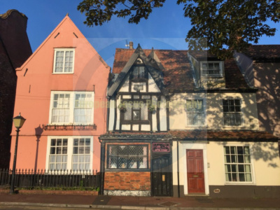
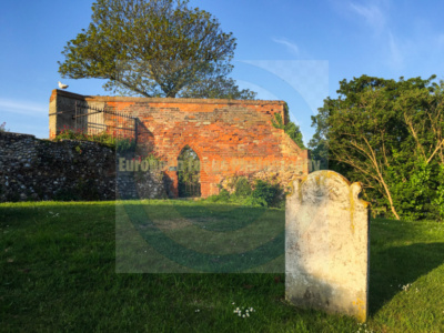
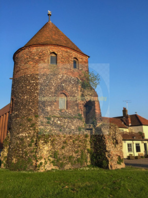
The town suffered from bombing raids by the German Luftwaffe during World War II, as the last significant place Germans could drop bombs before returning home, but much is left of the old town, including the original 2,000-metre (1.2 mi) protective medieval wall, of which two-thirds has survived, and eleven of the eighteen towers remain. On the South Quay is a 17th-century Merchant’s House, as well as Tudor, Georgian and Victorian buildings. Behind South Quay is a maze of alleys and lanes known as “The Rows”. Originally, there were 145. Despite war damage, several have remained.
The town was badly affected by the North Sea flood of 1953. More recent flooding has also been a problem, with four floods in 2006, the worst being in September. Torrential rain caused drains to block and an Anglian Water pumping station to break down, which caused flash flooding in which 90 properties were flooded up to 5 ft (1.5 m).[21]
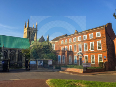
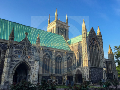
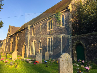
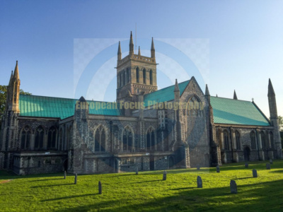
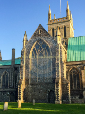
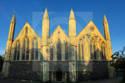
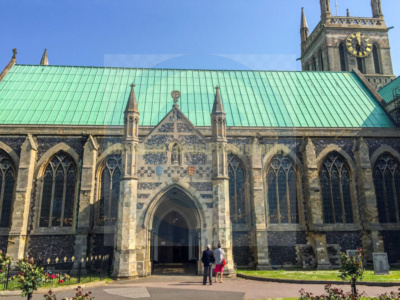
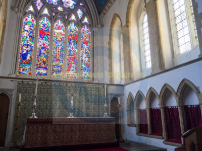
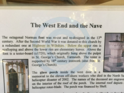
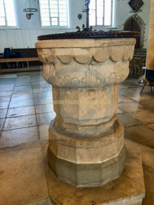
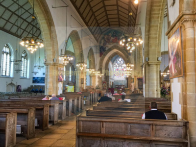
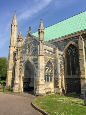
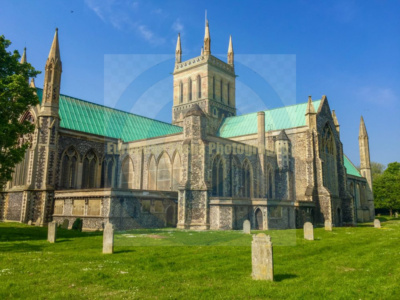
The Minster Church of St Nicholas is the minster and parish church of the town of Great Yarmouth, in Norfolk, England. It was built during the Norman era and is England’s third largest parish church, behind Beverley Minster in East Yorkshire (37,560 square feet; 3,489 m2) and Christchurch Priory in Dorset (30,300 square feet; 2,815 m2).[1] It was founded in 1101 by Herbert de Losinga, the first Bishop of Norwich,[2] and consecrated in 1119. It is cruciform, with a central tower, which may preserve a part of the original structure. Gradual alterations effectively changed the form of the building. Its nave is 26 feet (7.9 m) wide, and the church’s total length is 236 feet (72 m).
In December 2011, the Bishop of Norwich officially designated it a Minster Church. It is not only used for religious services but is a hub for various other regional and civic events, including concerts by choirs, orchestras and other musical ensembles, art exhibitions and, during festivals and fayres, the church opens permitting stalls and traders inside. It is also a Grade-II* listed building.[3]
The building
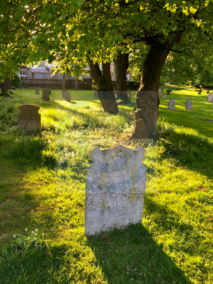
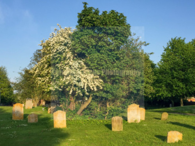
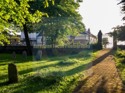
The building, very possibly the town’s oldest, is also its most visible, historic landmark. It sits in the central area of Great Yarmouth, close to the house of Anna Sewell.[2] The Transitional clerestoried nave, with columns alternately octagonal and circular, was rebuilt in the reign of King John. A portion of the chancel is of the same date. About fifty years later the aisles were widened, so that the nave is now, rather unusually, the narrowest part of the building. Immediately adjacent are two main graveyard areas: the Old Yard lies directly east behind the church, while the very substantial New Yard stretches for about half a mile to the north.
Early history
A grand west front with towers and pinnacles was constructed between 1330 and 1338, but a plague interrupted building extension plans. In the 16th century the ornamental brasses were cast into weights and the gravestones cut into grindstones. Within the church there were at one time 18 chapels, some maintained by guilds, others by private families, such as the Paxtons. At the Reformation the chapels were demolished and the building’s valuable liturgical vessels sold off, the proceeds spent to widen the channel of the harbour.
Split church
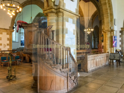
During the Commonwealth period, the Independents appropriated the chancel, the Presbyterians the north aisle, while Churchmen were allowed the remainder of the building. The interior brick walls, erected at this time to separate the different portions of the building, remained until 1847. In 1864 the tower was restored, and the east end of the chancel rebuilt; between 1869 and 1870 the south aisle was rebuilt; and in 1884 the south transept, the west end of the nave and the north aisle underwent restoration.
Recent history
During the Second World War, the building was bombed and nearly destroyed by fire. It was rebuilt by the architect Stephen Dykes Bower and reconsecrated in 1961. During reconstruction, the church temporarily used St Peter’s Church on St Peter’s Road. When St Nicholas reopened, attendance at St Peter’s declined until the 1960s, when a growing Greek community had use of it, and in 1981 it became St Spiridon’s Greek Orthodox Church.
On 2 October 2011, the Lord Bishop of Norwich Graham James raised St. Nicholas to the status of a Minster Church, so marked on 9 December 2011 during the town’s Civic Carol Service. Its formal title is now the Minster Church of St. Nicholas, Great Yarmouth.
Source: Wikipedia