Tiverton, Devon
Photographed by James Derheim, European Focus Private Tours, on May 30, 2017
The town’s name is conjectured to derive from “Twy-ford-ton” or “Twyverton”, meaning “the town on two fords”, and was historically referred to as “Twyford”. The town stands at the confluence of the rivers Exe and Lowman. Human occupation in the area dates back to the Stone Age, with many flint tools found in the area. An Iron Age hill fort, Cranmore Castle, stands at the top of Exeter Hill above the town, and a Roman fort or marching camp was discovered on the hillside below Knightshayes Court near Bolham, just to the north of the town.[4]
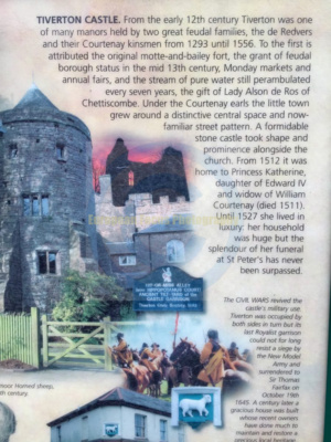
Tiverton formed part of the inheritance of Aethelweard, youngest son of King Alfred. Countess Gytha of Wessex controlled the town in 1066 and the Domesday Book indicates that William the Conqueror was its tenant-in-chief in 1086. Tiverton was also the seat of the court of the hundred of Tiverton.[5] It was the strategic site chosen by Henry I for a Norman castle, Tiverton Castle, first built as a Motte and Bailey in 1106.[6]
Tiverton has a medieval town leat, built for it by Countess Isabella de Fortibus, who was the eldest daughter of Baldwin de Redvers, 6th Earl of Devon and grew up at Tidcombe Hall, close to Tiverton. Isabella also controlled the Port of Topsham, Devon, through which much of Tiverton’s woollen exports were transported, mostly to the Low Countries. Every seven years there is a Perambulation of the Town Leat: a ceremony to clear the path of the leat and ensure it is kept running. The leat can be seen in Castle Street, where it runs down the centre of the road, and at Coggan’s Well, in Fore Street.[7]
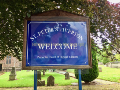
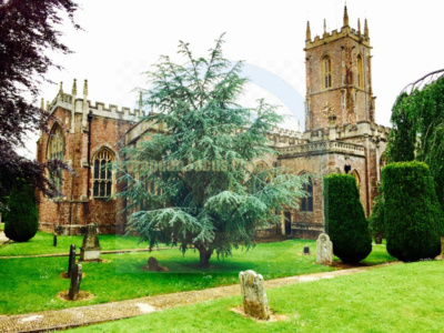
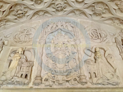
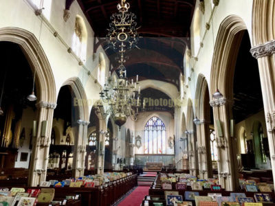
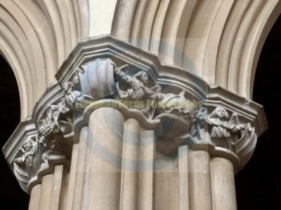
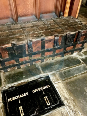
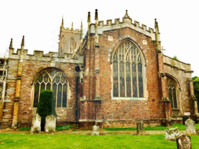
Tiverton owes its early growth and prosperity to the wool trade, which caused the town to grow rapidly in the 16th and 17th centuries. Many wealthy wool merchants added to the town’s heritage. John Greenway (1460–1529), for example, built a chapel and porch onto St Peter’s parish church in 1517, and a small chapel and almshouses in Gold Street, which still stand – the Almshouse Trust still houses people today. Peter Blundell, another wealthy merchant, who died in 1601, bequeathed the funds and land for Blundell’s School to educate local children. It was founded in Tiverton in 1604 and relocated to its present location on the outskirts of town in 1882, where it functions as an independent school.[8] John Waldron (died 1579) founded Waldron’s Almshouses, on Wellbrook Street, and his elaborate chest tomb survives in St Peter’s Church.[9]
Around the turn of the 17th century, there were two major fires in the town. The first, allegedly started in a frying pan, was in 1596 and destroyed most of the town. The second, in 1612, was known as the “dog-fight fire” – a dog fight had distracted those meant to be looking after a furnace.[10] The parish registers of Barnstaple reported of the second fire: “In the yere of or Lorde God 1612 in the 5th daye of the month of Auguste was the towne of Teverton burned the second tyme wth fyer to the nomber of 260 dwellynge howses.”[11]
During the English Civil War in 1645 Tiverton Castle, held by the Royalists, was the scene of a relatively brief siege by Thomas Fairfax’s Parliamentarian forces. The Parliamentarian forces entered Tiverton under Major General Massey on 15 October, the town’s defenders fleeing before him towards Exeter. They left a defending force in the castle and church. Fairfax arrived from Cullompton on 17 October, set up his artillery and bombarded the castle for two days, ceasing fire for the sabbath in the afternoon of Saturday 18 October. On Sunday Fairfax had “several great pieces” of artillery brought up, ready for a renewed barrage on Monday, which commenced at 7 a.m. The siege was ended when a lucky shot broke one of the drawbridge chains and an alert squad of Roundheads gained swift entry.[12]
Historic governance
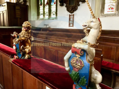
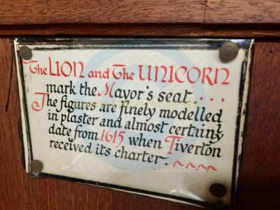
From the early 17th century until the mid-19th century, Tiverton was governed by the Tiverton Corporation, a self-selecting body established by royal charter in 1615 under King James I. The Corporation consisted of a mayor, aldermen, and councillors who exercised control over local justice, taxation, markets, education, and charitable endowments. It played a prominent role in regulating the town’s wool trade and public infrastructure. In the late 18th century, the Corporation became closely associated with the political interests of the Ryder family, later the Earls of Harrowby, who dominated parliamentary representation and civic appointments.
The Corporation was reformed and ultimately abolished under the Municipal Corporations Act 1835, after which an elected borough council was established.
18th and 19th centuries
The town enjoyed prosperity from the wool trade in the early 18th century. However, a period of decline followed during the early Industrial Revolution. There were occasional riots, and societies of woolcombers and weavers were formed in an effort to protect jobs and wages. By the end of the century, imports of cotton and the expansion of industrialization elsewhere, along with the effect of the Napoleonic Wars on exports, took the town’s woollen industry into terminal decline.[13] In June 1731 another fire destroyed 298 houses, causing £58,000 worth of damage. After this, the streets were widened.[14] In May 1738, riots broke out in the town.[15]
The industrialist John Heathcoat bought an old woollen mill on the river Exe in 1815, and after the destruction of his machinery at Loughborough by former Luddites thought to be in the pay of Nottingham lacemakers, he moved his whole lace-making operation to Tiverton.[16] Many of his workers walked from Loughborough to Tiverton, a distance of at least 200 miles.[17] The factory turned the fortunes of Tiverton again, making it an early industrial centre in the South West. Trade was aided when a branch of the Grand Western Canal from Tiverton to Lowdwells was opened in 1814, with an extension to Taunton in 1838. This was followed by a branch of the Great Western Railway in 1848.[18] The population at the time of the 1841 census was 7,769 inhabitants.[19] Tiverton Town Hall, elaborately designed by Henry Lloyd, was completed in 1864.[20]
Although small, Tiverton had two members of Parliament. As one of the “rotten boroughs” it was often targeted by those seeking electoral reform. Lord Palmerston, or “Pam” as he was known locally, was an MP for Tiverton for much of the 19th century. In 1847, the Chartists, a radical group seeking to change the electoral system, stood one of their leaders, George Julian Harney, against Palmerston. He is widely reported as having gained no votes – but in fact he won the “popular vote” (a show of hands of the people of the town) and withdrew when Palmerston called a ballot, aware that he would lose in a vote by only 400 wealthy and propertied in the town out of a population of 7,000. Broadening the franchise was one of the Chartist objectives. After the Reform Act 1867, Tiverton had a single MP, held for a long period by a member of the Heathcoat-Amory family, who own much of the land and property surrounding Tiverton, most recently by Derick Heathcoat-Amory who served from 1945 to 1960. Up until 2010 David Heathcoat-Amory was the MP for Wells in nearby Somerset.[21]
The town was the last in the Devon and Cornwall area to retain an independent police force, until 1945. In the second half of the 20th century, Tiverton again declined slowly, as the Heathcoat factory became ever more mechanised and the Starkey Knight & Ford brewery was taken over by Whitbread as its regional brewery, but later closed, becoming just a bottling plant located in Howden (now Aston Manor cider makers). The factory lay derelict for some years before being demolished to make way for a supermarket. The manufacture of agricultural machinery adjacent to the River Lowman dwindled, the railway closed in 1964 and the Globe Elastic plant in Kennedy Way closed in the 1980s. However, a few far-sighted individuals, notably William Authers, secured some important assets for the future. Tiverton Museum was opened, the track bed of the old railway was bought to provide footpaths and an adventure playground, and the Grand Western Canal was saved from dereliction as a country park.[22]
Retailing in the town declined further in the 1990s after the opening of the Southern Relief Road (now Great Western Way) led to the closure of Fore Street in the town centre to all but pedestrians.
Source: Wikipedia